Erosion
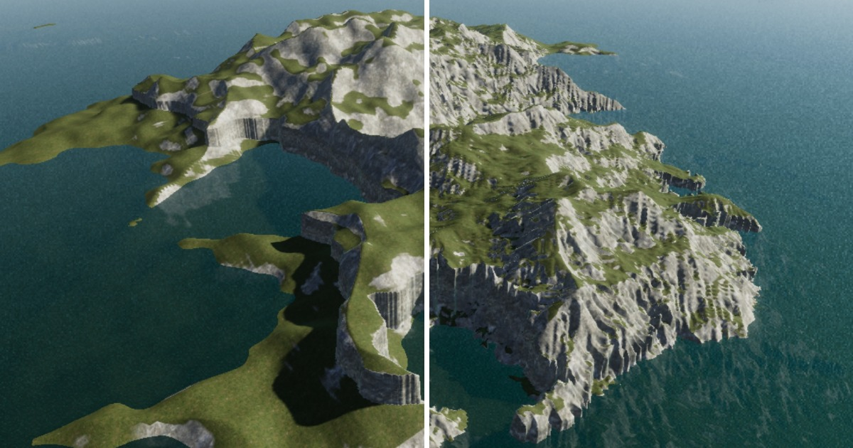
Overview of the Erosion Generator The Erosion Generator in Map Generator simulates the erosive effects of water flowing across a terrain's surface. It replicates processes such as the erosion of cliffs, the transportation of eroded material to new locations, and the settling of sediment. It's important to note that the calculations involved in flows, erosion, and sediment are iterative and resource-intensive, making the Erosion Generator the slowest among all Map generators. However, the results it produces are typically well worth the computational effort.
Properties:
Iterations: Specifies the number of passes the generator should perform. The number of iterations directly influences performance. In most cases, setting it to a value between 5 and 7 is sufficient, as further erosion becomes less perceptible.
Durability Factor: Determines how resistant the input terrain is to erosion. Lower values result in more significant erosion with each iteration but may make the overall outcome less accurate and predictable. It is recommended to set this value to 0.8 or higher for more reliable results. A value of 1 implies no erosion.
Sediment Factor: Multiplies the amount of stratum that settles out of the flow. A value of 0 indicates that all eroded material is disintegrated or carried away, leaving no sediment. Conversely, a value of 2 magically doubles the amount of sediment before settling. Realistic values typically fall slightly below 1, but satisfactory outcomes can be achieved within the entire 0-2 value range.
Use Cases:
Creating Realistic Terrains: The Erosion Generator is crucial for achieving realistic terrain features, including the formation of valleys, riverbeds, and the gradual wear and tear of landscapes.
Natural Landscape Simulation: It's valuable for simulating the natural effects of water erosion over time, enhancing the authenticity of virtual terrains.
The Erosion Generator empowers map creators to introduce the dynamic effects of water erosion to their landscapes, adding realism and authenticity to virtual terrains. While it may require some additional processing time, the results are often well worth the effort.